| Code* |
SRP05070601 |
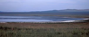
SRP05071002 |
SRP05071003 |
| GPS N |
50.04519 |
49.74339 |
49.90725 |
| GPS E |
105.36084 |
103.10503 |
102.65665 |
| Elevation m |
706 |
936 |
970 |
| Site Name |
Wetland |
Wetland |
Wetland |
| Aimag |
Selenge |
Bulgan |
Bulgan |
| Soum |
Tsagaannuur |
Teshig |
Teshig |
| Location Description** |
Wetland 10.1 km SW of town of Tsagaanuur |
Wetland near confluence of Tariakhtain Gol and Egiin
Gol |
Wetland 4.3 km SSW of Teshig |
| Click on Site Photograph to enlarge |
|
|
|
Date |
7/6/2005 |
7/10/2005 |
7/10-11/2005 |
| Wetland Type |
Lacustrine |
Lacustrine |
Lacustrine |
| Water temp deg C |
24.5 |
25.5 |
23.4 |
| Conductivity uS/cm |
447 |
332 |
1512 |
| DO ppm |
14.5 |
9.82 |
ND |
| DO % Saturation |
164 |
120.3 |
16.8 |
| TDS (ATC) ppm |
ND |
165 |
732 |
| Turbidity NTU |
ND |
ND |
11.5 |
| pH |
9.41 |
9.42 |
8.85 |
| Phosphate mg/L |
ND |
ND |
0.27 |
| Nitrate (NO3-N) mg/L |
ND |
ND |
0.51 |
| Nitrite (NO2) mg/L |
ND |
ND |
0.099 |
| Watershed Characterization: Estimate from outer banks to 1 km out |
| % Forest |
0 |
20 |
5 |
| % Shrubs |
0 |
10 |
10 |
| % Forbs |
20 |
35 |
35 |
| % Grasslands |
80 |
35 |
50 |
| % Other |
0 |
0 |
0 |
| Landuse in Watershed: Estimate from outer banks to 1 km out |
| % Grazing |
50 |
20 |
55 |
| % Town |
0 |
0 |
0 |
| % Ger |
0 |
10 |
5 |
| % Mining |
0 |
0 |
0 |
| % Natural |
0 |
50 |
30 |
| % Other |
50 WHEAT |
20 WHEAT |
10 CROP |
| Channel Characterization: Left Descending Bank, Estimate
from stream to highest outer bank |
| % Forest |
ND |
ND |
ND |
| % Shrubs |
ND |
ND |
ND |
| % Forbs |
ND |
ND |
ND |
| % Grasslands |
ND |
ND |
ND |
| % Other |
ND |
ND |
ND |
| Channel Characterization: Right Descending Bank, Estimate
from stream to highest outer bank |
| % Forest |
ND |
ND |
ND |
| % Shrubs |
ND |
ND |
ND |
| % Forbs |
ND |
ND |
ND |
| % Grasslands |
ND |
ND |
ND |
| % Other |
ND |
ND |
ND |
| Estimates of Grazing and Erosion |
| Grazing** |
4 |
1 |
2 |
| Erosion in Watershed*** |
3 |
0 |
2 |
| Erosion in Stream Channel**** |
ND |
ND |
ND |
Notes:
ND = No Data
* Code = Selenge River Project (SRP) followed
by two digits for year, two digits for month and two digits for day
and two digits for site number sequence for that day.
** = distance
almost always based on GPS calculation as straight line distance
***Grazing
Codes: 0=no grazing evident; 1=slight grazing; 2=moderate grazing;
3=heavy/mixed grazing; 4=heavy grazing.
****Erosion in Watershed Codes:
0=no erosion evident; 1=slight erosion; 2=moderate erosion; 3=heavy/mixed
erosion; 4=heavy erosion.
*****Erosion in Watershed Codes: 0=no erosion
evident; 1=slight erosion; 2=moderate erosion; 3=heavy/mixed erosion;
4=heavy erosion.
Back to top |